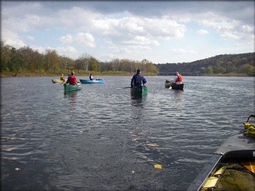
It is no wonder that much of the Delaware River makes a great water trail. Nonprofit environmental and recreational organizations, local residents and businesses, and federal, state and local governments have joined in a cooperative effort to guide and enhance river access opportunities through the development of a water trail system. This system includes uniform signage, maps, a trail guide and an interactive web site.
Th ere are more than 150 designated water trails throughout the United States connecting people to water resources. Water trails are boat routes suitable for canoes, kayaks and small-motorized watercraft. Like conventional trails, water trails are recreational corridors between specific locations. The Delaware River Water Trail includes guided access points and day use and/or camping sites for the boating public. It provides one-stop trip planning information that considers the river as a whole system, where and how to navigate it safely and appropriately, and ways to help protect its resources.
The Delaware River is the longest un-dammed river in the United States east of the Mississippi, extending 330 miles from the confluence of its East and West branches at Hancock, N.Y. to the mouth of the Delaware Bay where it meets the Atlantic Ocean. This water trail covers almost 200 miles of the entire freshwater portion of the Delaware River, from Hancock, New York to Trenton, NJ/Morrisville, PA.
The Delaware stands out as one of the most remarkable rivers in the nation: so rich in recreational, scenic, historic and natural resources that three quarters of the non-tidal river (about 150 miles) is included in the National Wild and Scenic Rivers System. Although the river only covers about 0.4 percent of the United States as it journeys from the mountains to the Delaware Bay, it supplies drinking water for about 7% of the nation's population—including the cities of New York and Philadelphia.
Visit the Delaware River Water Trail website here.